Property Record
265 State Route 15 N, Wharton, NJ 07885
NEARBY LISTINGS FOR SALE OR LEASE
Property Detail
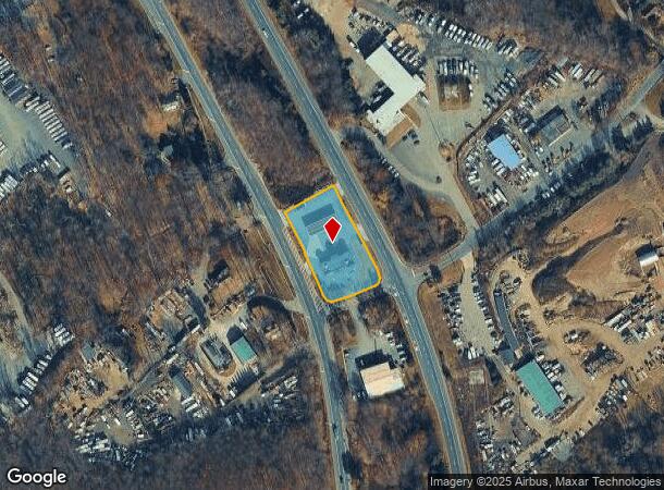
265 State Route 15 N
Newark, NJ-PA
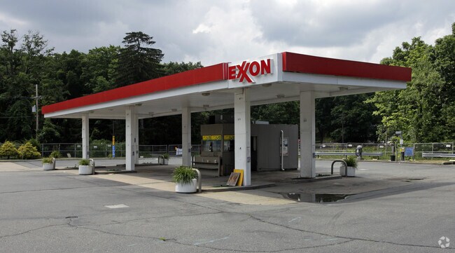
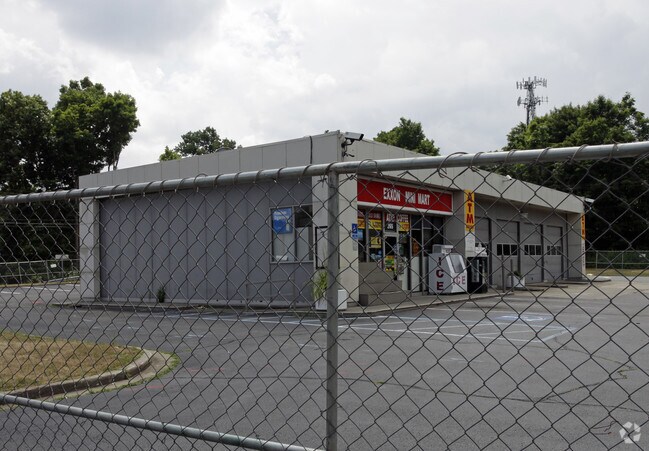
FACILITY NAME: EXXON GAS STATION
14-00267-01-00001
Morris
Commercialnec
New Jersey
2024
1
2025
1.09 AC
045100
Western Morris
3,040 SF
Northern New Jersey
DEMOGRAPHICS near 265 State Route 15 N
1 Mile
3 Mile
5 Mile
2024 Total Population
1,183
20,754
98,161
2029 Population
1,183
20,959
98,617
Pop Growth 2024-2029
0.00%
+ 0.99%
+ 0.46%
Average Age
41
44
42
2024 Total Households
426
8,375
36,805
HH Growth 2024-2029
0.00%
+ 1.00%
+ 0.53%
Median Household Inc
$105,357
$102,258
$97,057
Avg Household Size
2.80
2.40
2.60
2024 Avg HH Vehicles
2.00
2.00
2.00
Median Home Value
$542,208
$382,215
$348,787
Median Year Built
1983
1969
1965
Nearby Places
Map Layers
Map Styles
 Street
 Aerial
- Restaurants
- Banks
- Shops
- Fitness
- Groceries
PUBLIC TRANSPORTATION
COMMUTER RAIL
Dover (Montclair-Boonton Line - NJ Transit Commuter Rail (NJ Transit), Morris & Essex Morristown Line - NJ Transit Commuter Rail (NJ Transit))
DRIVE
WALK
Distance
Dover (Montclair-Boonton Line - NJ Transit Commuter Rail (NJ Transit), Morris & Essex Morristown Line - NJ Transit Commuter Rail (NJ Transit))
7 min
4.7 mi
Mount Arlington (Montclair-Boonton Line - NJ Transit Commuter Rail (NJ Transit), Morris & Essex Morristown Line - NJ Transit Commuter Rail (NJ Transit))
DRIVE
WALK
Distance
Mount Arlington (Montclair-Boonton Line - NJ Transit Commuter Rail (NJ Transit), Morris & Essex Morristown Line - NJ Transit Commuter Rail (NJ Transit))
8 min
5.7 mi
AIRPORT
Newark Liberty International
DRIVE
WALK
Distance
Newark Liberty International
46 min
34.3 mi
Freight Ports
Maher Terminal
DRIVE
WALK
Distance
Maher Terminal
48 min
34.8 mi
Nearby Properties
Address
Land Use
TOTAL SIZE
Lot Size
Zoning
Address
Land Use
TOTAL SIZE
Lot Size
Zoning
1,023 SF
143.31 AC
OR-3
Address
Land Use
TOTAL SIZE
Lot Size
Zoning
6,271.80 AC
R20A
Address
Land Use
TOTAL SIZE
Lot Size
Zoning
401,303 SF
59.54 AC
R-B
Address
Land Use
TOTAL SIZE
Lot Size
Zoning
5,686 SF
557.09 AC
M
Address
Land Use
TOTAL SIZE
Lot Size
Zoning
Address
Land Use
TOTAL SIZE
Lot Size
Zoning
23.66 AC
I1
Address
Land Use
TOTAL SIZE
Lot Size
Zoning
3.01 AC
Address
Land Use
TOTAL SIZE
Lot Size
Zoning
97,716 SF
60.89 AC
0-2
Address
Land Use
TOTAL SIZE
Lot Size
Zoning
19,106 SF
19.25 AC
R-B
Address
Land Use
TOTAL SIZE
Lot Size
Zoning
8.08 AC
I-1
Address
Land Use
TOTAL SIZE
Lot Size
Zoning
153,609 SF
17.54 AC
R-B
Address
Land Use
TOTAL SIZE
Lot Size
Zoning
261,582 SF
18.38 AC
R-B
Address
Land Use
TOTAL SIZE
Lot Size
Zoning
25.95 AC
I-1
Address
Land Use
TOTAL SIZE
Lot Size
Zoning
30.90 AC
I-2
Address
Land Use
TOTAL SIZE
Lot Size
Zoning
68,016 SF
6.53 AC
R-B
Address
Land Use
TOTAL SIZE
Lot Size
Zoning
268,774 SF
10.96 AC
0-2
Address
Land Use
TOTAL SIZE
Lot Size
Zoning
187,852 SF
15 AC
R-B
Address
Land Use
TOTAL SIZE
Lot Size
Zoning
39,740 SF
5.33 AC
R-B
Address
Land Use
TOTAL SIZE
Lot Size
Zoning
111,822 SF
11.59 AC
IND
Address
Land Use
TOTAL SIZE
Lot Size
Zoning
150,238 SF
9.32 AC
R-B
Address
Land Use
TOTAL SIZE
Lot Size
Zoning
80,016 SF
5.85 AC
R-B
Address
Land Use
TOTAL SIZE
Lot Size
Zoning
11.07 AC
I
Address
Land Use
TOTAL SIZE
Lot Size
Zoning
362.82 AC
PRD1
Address
Land Use
TOTAL SIZE
Lot Size
Zoning
80,800 SF
6.50 AC
I
Address
Land Use
TOTAL SIZE
Lot Size
Zoning
80,800 SF
8.23 AC
I
Address
Land Use
TOTAL SIZE
Lot Size
Zoning
9.50 AC
AH-2
Address
Land Use
TOTAL SIZE
Lot Size
Zoning
Address
Land Use
TOTAL SIZE
Lot Size
Zoning
3.90 AC
RG-5
Address
Land Use
TOTAL SIZE
Lot Size
Zoning
33,724 SF
5.49 AC
R-B
Address
Land Use
TOTAL SIZE
Lot Size
Zoning
1.87 AC
RM75
The World's #1 Commercial Real Estate Marketplace
Connect with us
© 2025 CoStar Group
The information above has been obtained from sources believed reliable. While we do not doubt its accuracy we have not verified it and make no guarantee, warranty or representation about it. It is your responsibility to independently confirm its accuracy and completeness. Any projections, opinions, assumptions, or estimates used are for example only and do not represent the current or future performance of the property. The value of this transaction to you depends on tax and other factors which should be evaluated by your tax, financial, and legal advisors. You and your advisors should conduct a careful, independent investigation of the property to determine to your satisfaction the suitability of the property for your needs.